The Lab · CAD wing
From drone flight to dimensioned drawing.
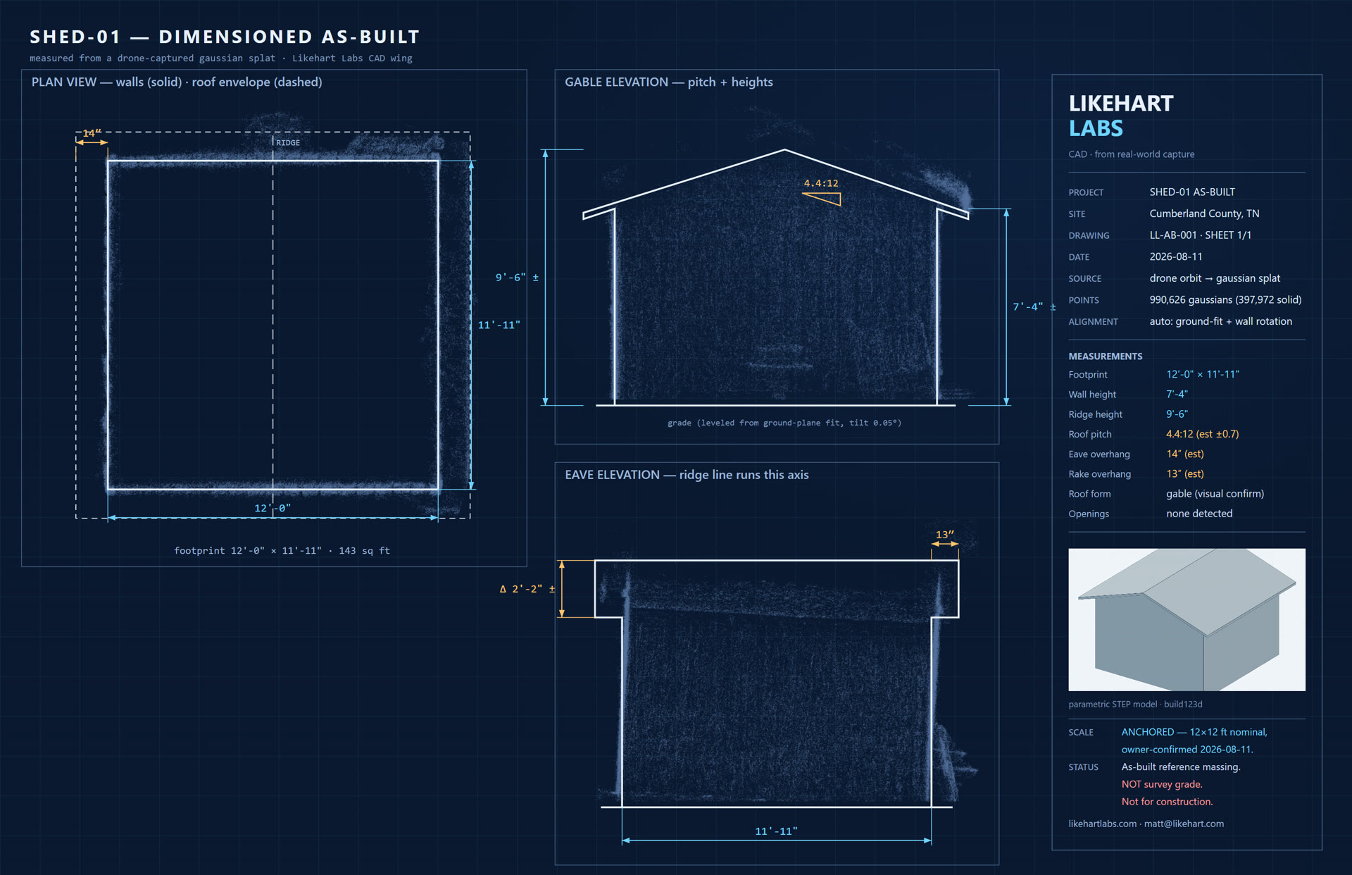
No tape measure touched this building. I flew a 10-minute orbit over a shed in Cumberland County, rebuilt it as a measurable 3D capture, and had algorithms pull the real dimensions out of nearly a million measured points — ground plane, wall alignment, eave, ridge, pitch. Then the lab drafted this.
How it works
Five steps. No guesswork.
Fly
A short drone orbit — ten minutes on site. For interiors, a phone walkthrough works too.
Rebuild
The footage becomes a gaussian splat — a photoreal 3D capture you can walk through in a browser.
Measure
Algorithms, not eyeballs: ground-plane fit, wall alignment, tree-canopy rejection. Every number traces to real points.
Model
A parametric CAD model — change the anchor dimension and every drawing regenerates in seconds.
Draft
A dimensioned as-built sheet plus a DXF that opens in AutoCAD, DraftSight, or any CAD app.
What it's for
The buildings nobody has drawings for.
- Garages, sheds, and pole barns before a renovation or addition
- Insurance and storm-damage documentation with real dimensions
- Listing sheets and floor references for realtors
- Shop and storage layouts you can actually plan against
Have a building with no drawings?
One site visit, and you get the capture, the model, and the drawing — yours to keep, in formats your contractor, insurer, or architect already uses.
Start the conversation matt@likehart.com